Ashburnham County
Dividing the Colony into Counties
If you ask contemporary school students how Australia is divided into smaller sections, they will inform you of the six states and two territories. A correct answer, and some of these students may be able to enlighten you that each state is divided into smaller sections – regions, towns, cities, villages and so on. The term ‘county’ may not be as familiar to students both young and old. There is an Ashburnham Road in Daroobalgie which is about 25km from Parkes off the Newell Highway (and only 16km from Forbes). However to most Parkes residents the term Ashburnham refers to something from a bygone era. Today, Local Government Areas (LGAs) are the third tier of government in Australia below state and federal governments. This was different when Australia was first settled by Europeans. The English were used to administrative terms such as parishes, counties and shires – the term ‘county’ can be traced back to the Norman era in England and is still in use today (Hampton, W. (1991). Local Government and Urban Politics.) J.F. Atchison, lecturer and formerly of the Geographical Names Board of New South Wales, explains why the English settlers required the compartmentalising of vast tracts of land in the new colony:
The erection of counties was demanded, as a requirement of control and administration, to keep pace with the progress of land settlement which, in turn, reflected the economic development of the colony.
Atchison, J.F. (1980) page 32
Without wanting to burden readers with surveying jargon, the map of New South Wales was developed into a cadastral map. The colony of New South Wales was divided into counties. In turn each county was divided into parishes and within the parishes were the towns or cities. Over time, the town and city names have remained whilst parishes and counties have become obsolete to most of the general populace. The county that included the modern day Parkes Shire was called Ashburnham. Ashburnham included the following parishes:
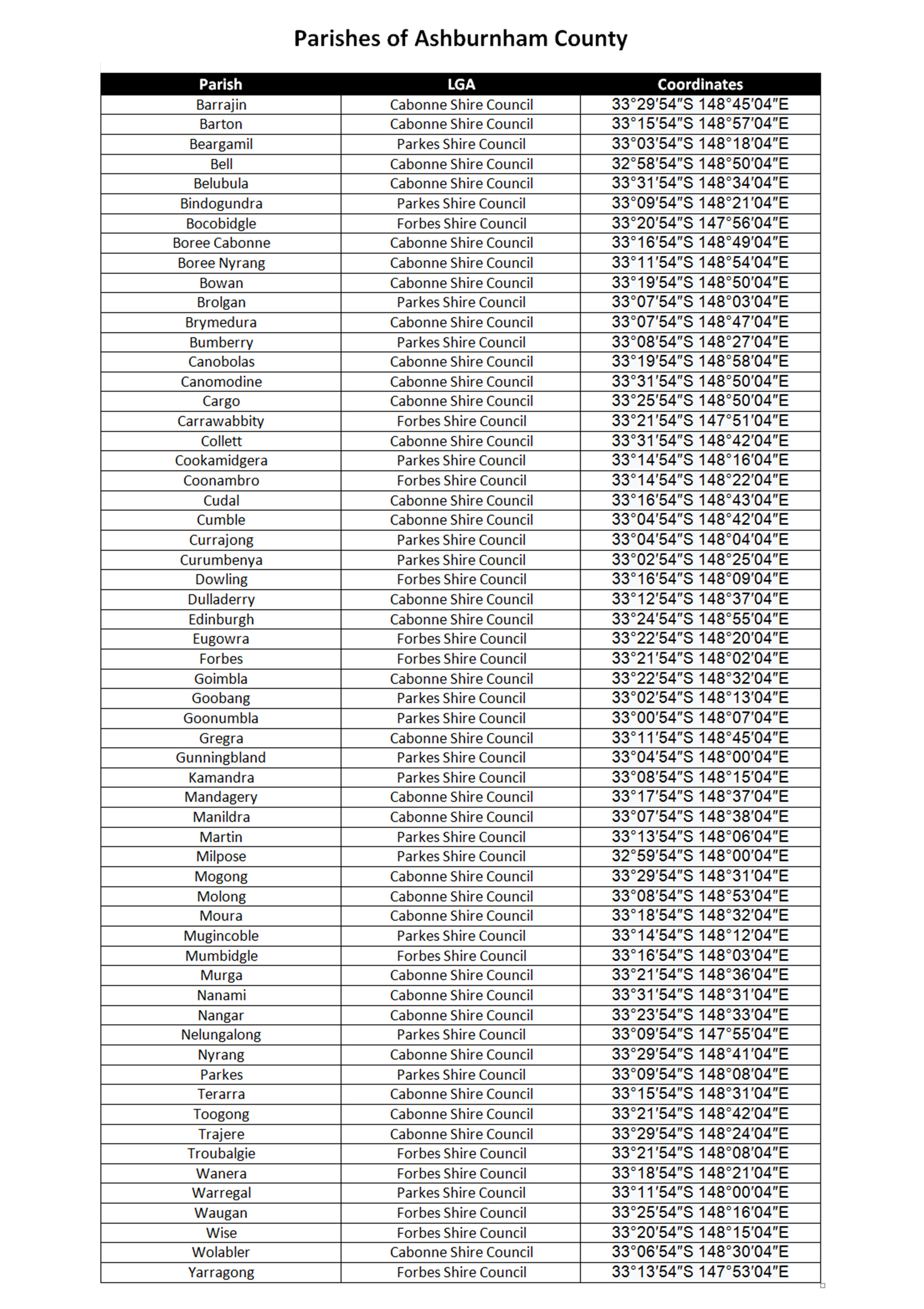
The complete list of parishes within the county of Ashburnham. Also included are the LGAs each parish falls under today. Source: Wikipedia
The counties surrounding Ashburnham are Kennedy and Gordon to the north; county of Wellington to the north east; county of Bathurst to the south east; county of Forbes to the south; Gipps in the south west; and Cunningham to the west.
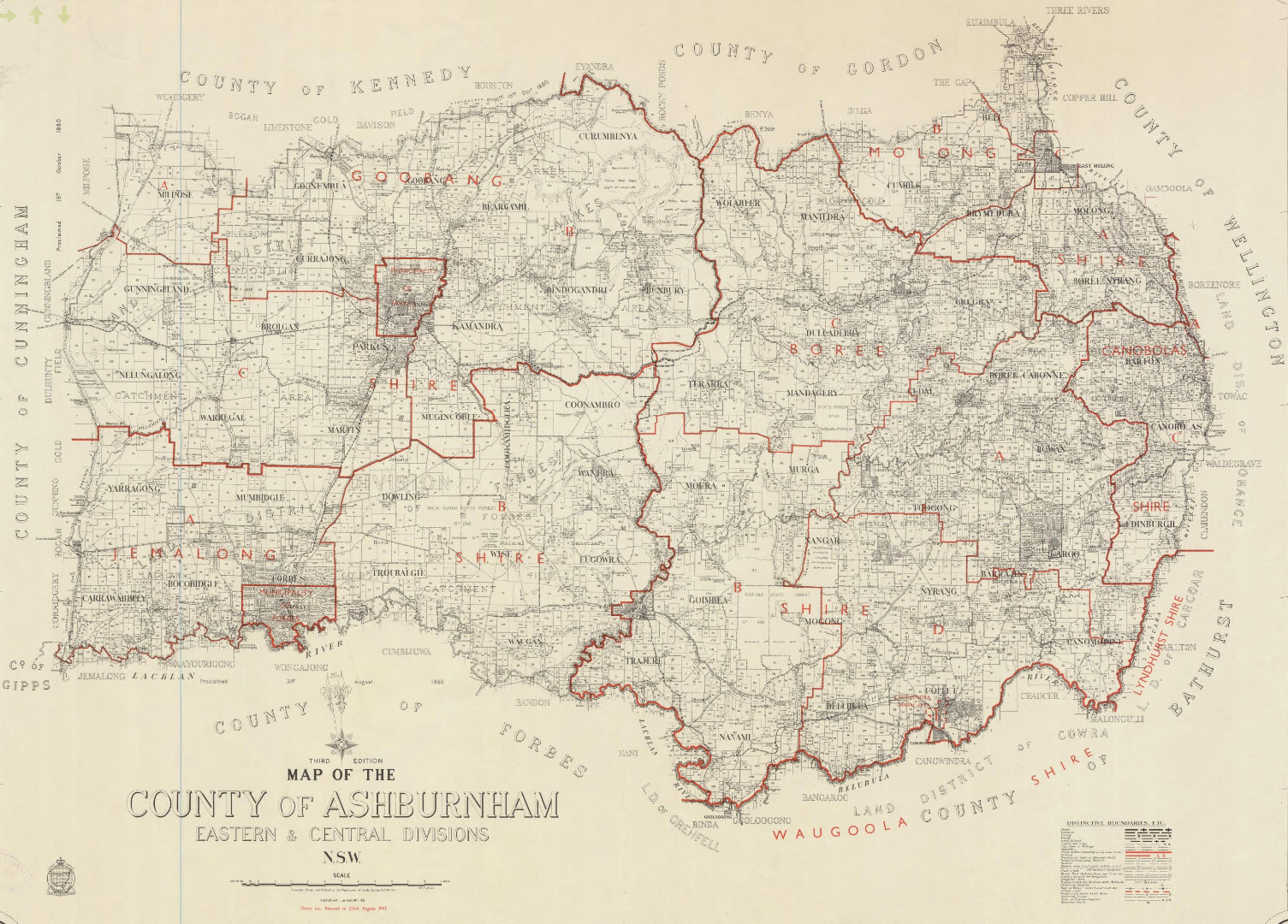
Map of the County of Ashburnham, dated 4th January 1933. Created by the NSW Department of Lands. Source: Trove website
Ashburnham became a county in 1850 and was one of many swift developments in the colony as reported by Atchison.
With the proclamation of the Orders-in-Council in 1847 central government authorities acted quickly to prevent the rise of unwanted townships and to survey the sites of halting places along the main thoroughfares. This, with the requirement of squatters to register the boundaries of their runs, accelerated the need for new counties. At the end of 1848 Governor Charles FitzRoy proclaimed a group of thirty one counties but only fifteen of them fell within New South Wales as presently constituted: Beresford, Buccleuch, Buckland, Clarence, Cowley, Dampier, Dudley Hawes, Parry, Raleigh, Richmond, Rous, Vernon, Wallace and Wellesley.
Two years later, as the Survey Department geared up for the days of more intensive cadastral survey and as the courts prepared for adjudication on boundary disputes between litigious squatters, Surveyor-General Thomas Mitchell authorised the erection of a further 32 counties, eighteen of which fell within the present boundaries of the State: Ashburnham, Buller, Clarendon, Clive, Darling, Drake, Gordon, Goulburn, Gowen, Gresham, Harden, Inglis, Lincoln, Monteagle, Napier, Pottinger, Sandon and Wynyard.
Atchison, J.F. (1980) page 34
Today counties are almost unknown, with different terms used. Atchison points out that
Although the county system of territorial division did not prove useful as a unit of local government in New South Wales it, along with the parish in the central and eastern divisions, does survive in the land survey as a means of describing allotments in deeds. For much of the nineteenth century the county was also a statistical area for collecting data on population, pastoralism and agriculture. Within the settled districts the counties were used as the basis of the electoral divisions.
Atchison, J.F. (1980) page 32
The Origin of Ashburnham
Like a lot of Australian landmarks the origin of its name began in the United Kingdom. In regards to Ashburnham, this can be traced back to the Derbyshire Dales and a derivation of the name, Esseburne, can be found in the Domesday Book.
The surname Ashburnham was first found in Derbyshire, at Ashbourne, a market town in the Derbyshire Dales now famous for its historic Shrovetide football match. The first record was found in the Domesday Book where it was listed as Esseburne, having derived from the Old English aesc + burna, meaning “stream where the ash-trees grow”
Source: House of Names website
It may seem strange to modern readers that so many counties were named after British aristocracy or military leaders. However even in the Anglo-centric days of colonialism there was the beginning of a movement to more Australian names. Captain Arthur Phillip drank a toast to the County of Cumberland (King George III’s brother was Henry Frederick, the Duke of Cumberland) in 1788 and this pattern of naming figures who had no connection with the colony continued until 1860. Michael Fitzpatrick, Under-Secretary for Lands, initiated “…usage of names with local significance”. John Robertson, Secretary for Lands, not only agreed but also suggested that Aboriginal place-names were desirable. Further support came from Reverend John Dunmore Lang who also favoured Aboriginal names that were closely identified with particular places. (Atchison, J.F. (1980) pp 33, 36)
So influential were the aforementioned men that Acting Surveyor-General, Alexander McLean, prepared “… another list of 54 names, which were mainly local. Fifteen were of Aboriginal origin but no language or dialect grouping was listed and no meanings, sacred, legal, social or hunting association, were indicated; let alone the Aboriginal source of the name.” (Atchison (1980) page 37)
Reverend Lang was so moved towards a push for Aboriginal place names that Atchison records his poem:
I like the native names, as Parramatta,
And Illawarra, and Woolloomoolloo,
Nandowra, Woogarora, Bulkomatta,
Tomah, Toongabbie, Mittagong, Meroo;
Buckobble, Cumleroy, and Coolingatta,
The Warragumby, Bargo, Burradoo;
Cookbundoon, Carrabaiga, Wingecarribbee,
The Wollondilly, Yurumbon, Bungarribbee.
I hate your Goulburn Downs and Goulburn Plains,
And Goulburn River and the Goulburn Range,
And Mount Goulburn and Goulburn Vale! One’s brains
Are turned with Goulburns! Vile scorbutic mange
For immortality! Had I the reins
Of Government for a fortnight, I would change
These Downing Street appellatives, and give
The country names that should deserve to live.”
Atchison, J.F. (1980) page 37
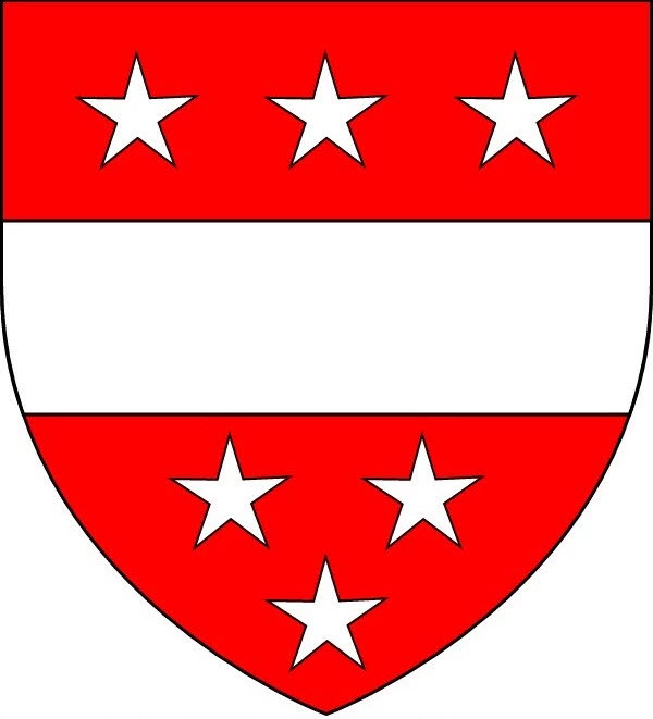
Family crest of the Ashburnhams. Source: Landed Family of Britain and Ireland blog
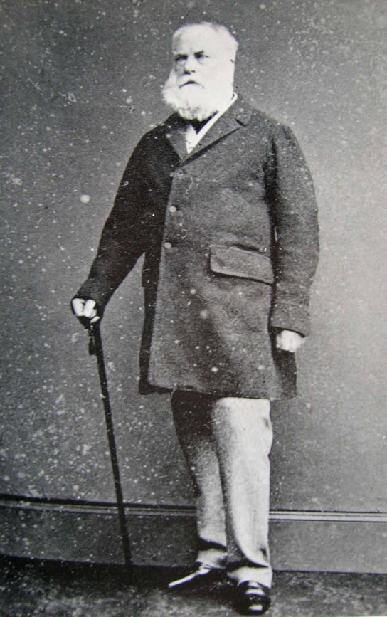
Photograph of the 4th Earl of Ashburnham, whom the county of Ashburnham in Central West NSW was named after. Source: Landed Families of Britain and Ireland blog
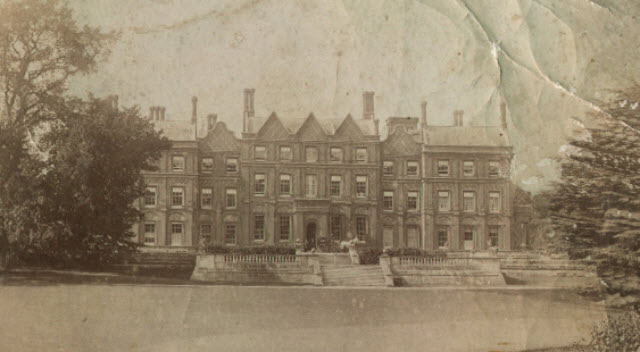
Photograph of Ashburnham Place in the late 19th century, home of 4th Earl of Ashburnham. Source: Landed Families blog
Bertram Ashburnham (1797-1878), 4th Earl of Ashburnham, was a great traveller and a fanatical collector of books and manuscripts, whose collections rivalled those of his contemporary, Sir Thomas Phillipps since if smaller they were arguably of greater significance. Unfortunately, he frequently bought material with a dodgy provenance, and when his son offered to sell his collections to the nation in the 1880s the French and Italian authorities pressed claims to some of the material, and the sales realised a much lower figure than he hoped and were only realised at the end of the century after much legal wrangling.
Excerpt from Landed Families blog
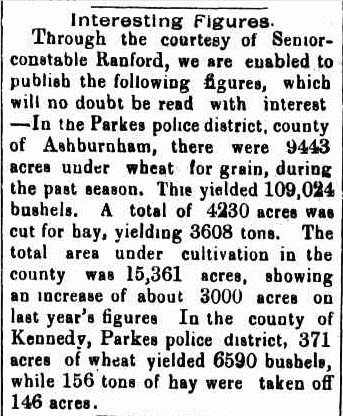
Newspaper report mentioning both the counties of Ashburnham and Kennedy. Source: Western Champion Friday 4 February 1898 page 8
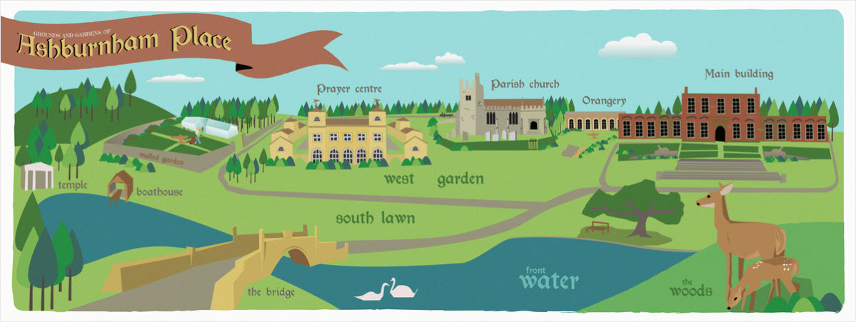
An illustrated map of the grounds and gardens of Ashburnham Place highlighting the extensive estate. Source: They Draw & Travel website
Click here to read about Kennedy County
Click here to read about Cunningham County
Parkes Shire Library would like to thank the following people and organisations for their assistance with this blog post:
- State Library & the Document Supply Service;
- staff of Parkes Shire Libraries;
- Trove.
If you have stories of Ashburnham county that you are willing to share please contact Parkes Shire Library via library@parkes.nsw.gov.au so that they can be shared and kept for posterity on this blog. Alternatively you may leave comments on this page.
REFERENCE LIST
- Hampton, W. (1991). Local Government and Urban Politics. London: Longman.
- Atchison, J F. “The Counties of New South Wales.” The Australian Surveyor, vol. 30, no. 1, Mar. 1980, pp. 32–43., https://statelibrarynsw-my.sharepoint.com/personal/shr_dds_sl_nsw_gov_au/Documents/DDS%20Root/DDS%20Shared%20Items/11-01-2018/000759.pdf?slrid=0a5e3f9e-2043-4000-ee5e-d1e383e32d50. Document Supply Service.
- Ashburnham County. (2017, October 18). Retrieved January 11, 2018, from https://en.wikipedia.org/wiki/Ashburnham_County
- New South Wales. Department of Lands, cartographer. (1965). Map of the County of Ashburnham : central & eastern divisions : N.S.W Retrieved January 12, 2018, from http://nla.gov.au/nla.obj-234367397
- Mills, A. D. (n.d.). Ashburnham Surname, Family Crest & Coats of Arms. Retrieved November 02, 2017, from https://www.houseofnames.com/ashburnham-family-crest
Includes a quote from Dictionary of English Place-Names by A.D. Mills Oxford: Oxford University Press, 1991. Print. (ISBN 0-19-869156-4)
- Ashburnham Family Crest[Photograph found in Earls of Ashburnham]. (2015, December 26). Retrieved November 2, 2017, from http://landedfamilies.blogspot.com.au/2015/12/200-ashburnham-of-ashburnham-place.html
- 4th Earl of Ashburnham[Photograph found in Earls of Ashburnham, Landed Families of Britain and Ireland]. (2015, December 26). Retrieved November 2, 2017, from http://landedfamilies.blogspot.com.au/2015/12/200-ashburnham-of-ashburnham-place.html
- Ashburnham Place [Digital image]. (2015, December 26). Retrieved January 12, 2018, from http://landedfamilies.blogspot.com.au/2015/12/200-ashburnham-of-ashburnham-place.html
- Interesting Figures. (1898, February 4). Western Champion (Parkes, NSW : 1898 – 1934), p. 8. Retrieved January 10, 2018, from http://nla.gov.au/nla.news-article112287768
- Serratti, T. (n.d.). Grounds and Gardens of Ashburnham Place [Map]. In They Draw & Travel. Retrieved January 17, 2018, from http://www.theydrawandtravel.com/illustrations/5981-gardens-and-grounds-of-ashburnham-place

Never new Ashburnham was the name of the county where Parkes is placed, although I have been to Ashburnham palace in the UK a few times as it is now in trust as a conference centre.
LikeLiked by 1 person
Thanks for your comments Raymond. Our history is amazing and we hope you enjoyed reading about it. All the best
LikeLike