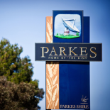
Narromine County
Aboriginal and Torres Strait Islanders are advised that the content below contains names of people who have died.
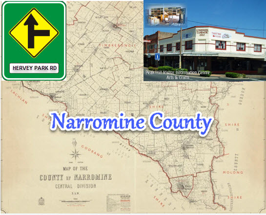
Montage to Narromine County. Background is the map of the county of Narromine. Overlayed are a replica of the road sign to Hervey Park Road, Peak Hill and a photograph Lindner Corner situated on Newell Highway and Mingelo Street, Peak Hill. Images source: Map from Trove; road sign made using images from Roads and Maritime Services and Snagit; and photograph from Parkes NSW website
Click here to read about Lindner Oval, Peak Hill
Continuing our series on the local counties of the early colony of New South Wales, this post focuses on the county of Narromine. Part of the 141 counties of New South Wales, Narromine was proclaimed a county in 1862 (the same year as Kennedy and Cunningham became counties and twelve years after the establishment of Ashburnham county) (Atchison, J.F. (1980) pages 39-42).
There are some differences to the story behind Narromine County to the other three counties that make up the Parkes Shire. Firstly, Narromine is not named after a person. It is also one of the then growing development to embrace Aboriginal words for places and landmarks. Prior to 1862, all county names were named after Europeans. Some were English aristocrats or military leaders – many of whom never even set foot in the colony (such as Bertram Ashburnham). Later others were Europeans who had impacted the colony of New South Wales in some way – explorers (such as Cunningham and Kennedy), governors or those with prominent occupations that assisted the European settlers here.
Aboriginal County Place Names in New South Wales
1862 Arrawatta, Baradine, Benarba, Caira, Courallie, Ewenmar, Menindie, Nandewar, Narromine, Taila, Tara, Urana, Wakool, Waljeers, Waradgery,
1875 Canbelego, Gunderbooka, Killara, Werunda, Yanda,
1884 Booroondarra, Culgoa, Irrara, Kilfera, Manara, Mootwinge, Mossgiel, Mouramba, Tandora, Thoulcanna, Tongowoko, Ularara, Yancowinna, Yantara, Yungnulgra
Atchison, J.F. (1980) pages 39-42
According to sources, Narromine was a name of a property in the area. This property owners (sadly lost in the mists of time for now) called their property Narromine which was Wiradjuri for “honey person”. This is mentioned on Wikipedia’s entry for Narromine (town) and Narromine (county) as is also found in The Romance of Australian Place Names a feature that appeared in The Australian Women’s Weekly Wednesday 13 May 1964 page 45.
![Snapshot from the website for Geographical Names Board of New South Wales. While not confirmed, it is believed to be a Wiradhuri [sic] term for "honey person". Source: Geographical Names Board of New South Wales website](https://historyparkes.org/wp-content/uploads/2018/01/gnb-for-narromine.jpg)
Snapshot from the website for Geographical Names Board of New South Wales. While not confirmed, it is believed to be a Wiradhuri [sic] term for “honey person”. Source: Geographical Names Board of New South Wales website
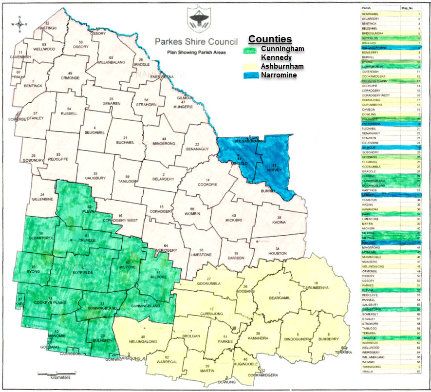
Map of the parish areas of Parkes Shire Council, with the county areas colourised for easier identification. Source: Parkes Shire Council
The first mention of Narromine found on Trove was in The Sydney Herald Tuesday 10 November 1840. The report, which can be viewed here, refers to a witness in a cattle theft case. The witness, Mr Arthur Wiggins, had a station at Narromine on the Macquarie. Sadly the article highlights the poor treatment of Aboriginal Australians in colonial days.

Another early mention of Narromine (although spelt Narramine) refers to another theft. This time it is a horse from Captain Raine whose superintendent was Arthur Wiggins mentioned in the aforementioned newspaper report. Source: The Sydney Herald Monday 26 April 1841 page 2
Another newspaper report mentioning Narromine and also highlighting to tension between the indigenous community and the colonial settlers. Read the full article here which can be found in The Sydney Herald Monday 22 September 1845 page 2
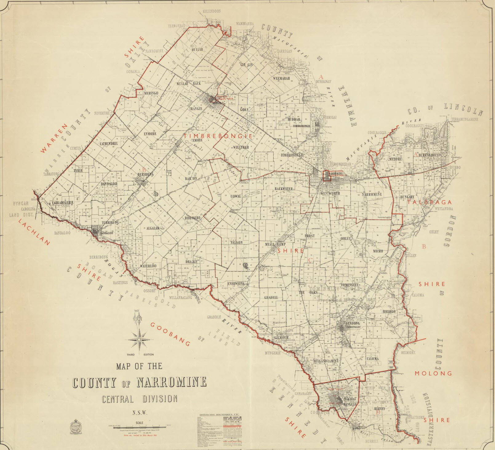
Reproduction of map of County of Narromine. Only the southern most parishes are part of the modern Parkes Shire Council. These parishes are Mingelo and Hervey. This map was compiled in 1961 Source: Trove
Click here to read about Kennedy County
Click here to read about the county of Ashburnham
Click here to read about Cunningham County
Parkes Shire Library would like to thank the following people and organisations for their assistance with this blog post:
- State Library & the Document Supply Service;
- Australian Dictionary of Biography website;
- Mitch Miles;
- staff of Parkes Shire Libraries;
- ABC Editorial Policies website;
- Trove
If you have stories of Narromine county that you are willing to share please contact Parkes Shire Library via library@parkes.nsw.gov.au so that they can be shared and kept for posterity on this blog. Alternatively you may leave comments on this page.
REFERENCE LIST
Feature Picture Images
- Road Sign made using template from Roads and Maritime Services website, and with Snagit Editor
- Peak Hill Visitor Information Centre & Arts and Crafts Centre [Digital image]. (n.d.). Retrieved February 2, 2018, from http://www.parkes-nsw.com/PeakHill.html
- New South Wales. Department of Lands. (1961). Map of the County of Narromine, Central Division, N.S.W Retrieved January 25, 2018, from http://nla.gov.au/nla.obj-233956322
xx
- Atchison, J F. “The Counties of New South Wales.” The Australian Surveyor, vol. 30, no. 1, Mar. 1980, pp. 39–42., https://statelibrarynsw-my.sharepoint.com/personal/shr_dds_sl_nsw_gov_au/Documents/DDS%20Root/DDS%20Shared%20Items/11-01-2018/000759.pdf?slrid=0a5e3f9e-2043-4000-ee5e-d1e383e32d50. Document Supply Service.
- Narromine. (2018, January 24). Retrieved January 30, 2018, from https://en.wikipedia.org/wiki/Narromine#cite_note-5
- Narromine County. (2016, September 24). Retrieved January 30, 2018, from https://en.wikipedia.org/wiki/Narromine_County#cite_note-1
- PLACE NAMES (1964, May 13). The Australian Women’s Weekly (1933 – 1982), p. 45. Retrieved January 31, 2018, from http://nla.gov.au/nla.news-article55185386
- Geographical Name Board of New South Wales. (n.d.). Extract. Retrieved January 30, 2018, from http://www.gnb.nsw.gov.au/place_naming/placename_search/extract?id=ujKqFxsEMa
- Parkes Shire Council. (2000). Parkes Shire Council Plan Showing Parish Areas[Map]. Parkes, NSW: Parkes Shire Council. Retrieved January 29, 2018.
- LAW INTELLIGENCE. (1840, November 10). The Sydney Herald (NSW : 1831 – 1842), p. 2. Retrieved January 25, 2018, from http://nla.gov.au/nla.news-article12866425
- Advertising (1841, April 26). The Sydney Herald (NSW : 1831 – 1842), p. 2 (Supplement to the Sydney Herald). Retrieved January 25, 2018, from http://nla.gov.au/nla.news-article12868844
- NEWS FROM THE INTERIOR. (1845, September 22). The Sydney Morning Herald (NSW : 1842 – 1954), p. 2. Retrieved January 25, 2018, from http://nla.gov.au/nla.news-article12882335
- New South Wales. Department of Lands. (1961). Map of the County of Narromine, Central Division, N.S.W Retrieved January 25, 2018, from http://nla.gov.au/nla.obj-233956322
